Boulder Skyline Traverse!
Boulder, CO, often known as the Boulder Bubble, is a magical place. It is a place where hipsters, bros, and outdoor enthusiasts gather. There are likely just as many yoga studios as there are dispensaries, hiking trails often appear in the middle of neighborhoods, and you can witness people biking to work in the middle of a snowstorm. The ambiance is so strong it is almost visible, and what better way to view the Bubble than from five separate peaks that make up the Skyline Traverse.
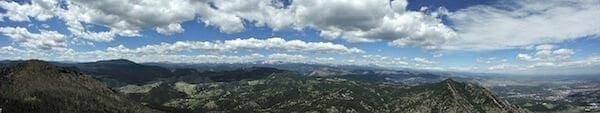
South Boulder Peak summit views
In one very long day, you can summit Mount Sanitas, Flagstaff Mountain, Green Mountain, Bear Peak, and South Boulder Peak. The trail itself is made up of a compilation of smaller section trails throughout the Front Range, but is known as either the Boulder Five Peaks Traverse or the Skyline Traverse. You can travel either North to South or South to North, but I recommend starting at Mount Sanitas and traveling south, finishing with South Boulder Peak.

Sunrise on the summit of Sanitas
The whole traverse covers just over 16 miles and will get your buns burning with over 6300 feet of elevation gain. The hike takes roughly 9 to 12 hours and will take you through dry Ponderosa pine forests, deeply shaded Subalpine firs, and across high elevation meadows. Whether you are training for a 14er or are simply ready to explore beyond Chautauqua this hike is bound to be a great time: flowers are out, birds are singing, and the smell of weed is in the air.
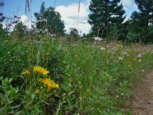
Flowers along Green Bear Trail
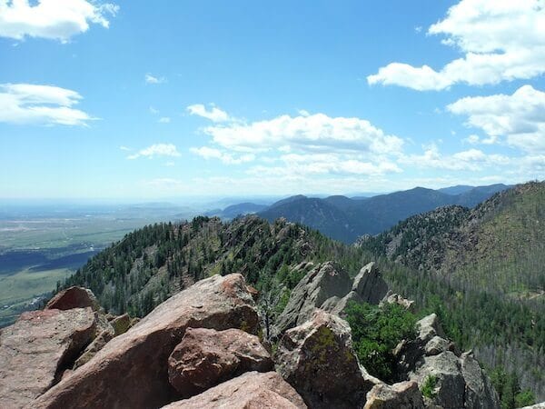
Summit of Green Mountain
Here are some directions to take you along this journey, but before heading out I recommend snagging a trail map and some Clif Bars.
Mount Sanitas
- Start at the Goat Trail on the North side of Mount Sanitas, from there take the East ridge to the summit.
- Descend Mount Sanitas Trail
Flagstaff Mountain
- Take Centennial TH, this will bring you to the Red Rocks Trail to Eben G. Fine Park
- You’re on pavement here, but cross Arapahoe to find the Viewpoint TH (this can be a bit tricky to find, check out a map, the trail appears in the middle of a neighborhood, really quite whimsical).
- Take Viewpoint to Panorama Point, continue up the Flagstaff Trail
- Continue to Flagstaff Summit area
Green Mountain
- Head south and you will begin a gradual descent on Ute Trail to Realization Point.
- Cross Flagstaff Road (for the last time) and head to the Ranger Trail (again a bit tricky to find, it is located near the old Green Mountain Lodge area)
- Take Ranger to Green Mountain West Ridge until you branch off east towards Green Mountain summit.
- To descend, head down the way you ascended, and go to the Green Bear Trail.
Bear and South Boulder Peak
- To reach Bear Peak summit, take Green Bear to Bear Peak West Ridge, this will take you all the way to the summit.
- Once at the Bear Peak summit, South Boulder Peak is visible across a short saddle to the south.
- Descend Bear Peak and cross the saddle to the summit.
- To descend, take Shadow Canyon Trail, use caution on this part, the trail is steep and rocks can be loose due to the flood.
- Finally, go drink a beer.