Boulder’s Royal Arch – Scenic Trail, History & Photo of the Day
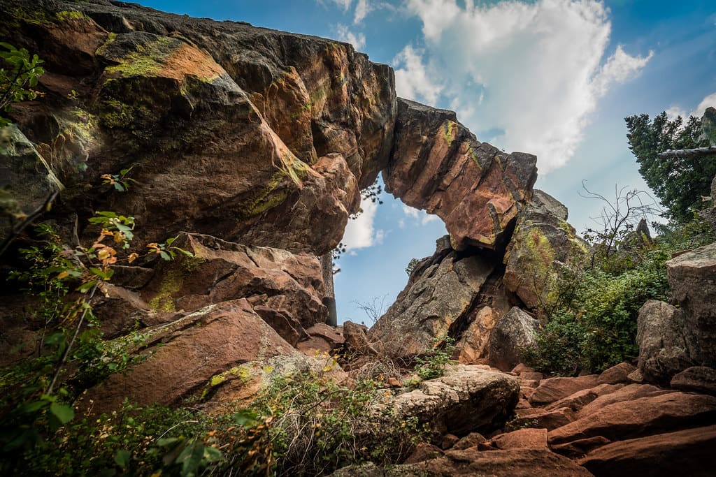
This morning’s Outdoor Picture of the Day brings us face-to-face with one of Boulder’s most iconic natural wonders: the Royal Arch. In the second image we’re showcasing today, the arch is illuminated by the soft, golden hues of early sunlight. The jagged Flatirons stand proudly in the distance, and the crisp blue sky frames the massive sandstone formation like a work of art. It’s a moment that captures both the wildness and serenity of Boulder’s foothills—a reminder of why this city is a hiking mecca.
A Landmark Steeped in History
The Royal Arch’s allure goes beyond its striking appearance. The original path to the arch dates back to the late 19th century when outdoor enthusiast “Rocky Mountain Joe” Sturtevant encouraged exploration of Boulder’s rugged terrain. By the 1920s, the City of Boulder had acquired the land, and official trails were established with the help of community groups. Although a damaging flood in 2013 temporarily closed the route, it was repaired and reopened within weeks—cementing its place as a symbol of Boulder’s resilience.

Hiking the Royal Arch Trail
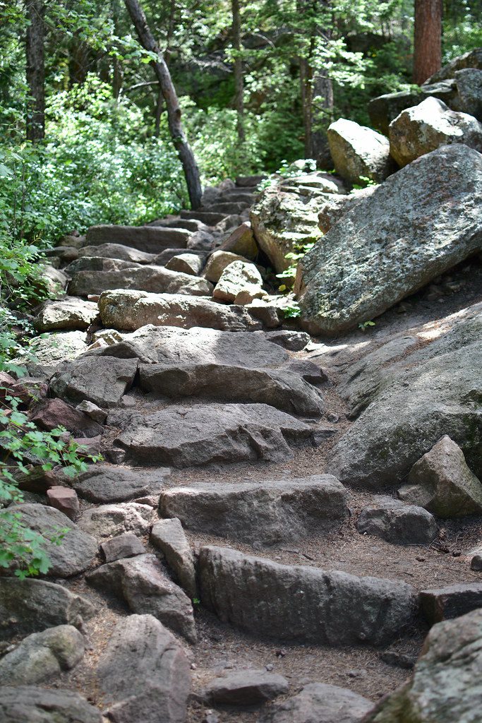
While beautiful, the Royal Arch Trail is not for the faint of heart. The out-and-back route covers roughly 3.4 miles and gains about 1,400 feet in elevation, making it a moderate-to-strenuous hike. The trail begins at the Chautauqua Trailhead, weaving through wildflower-lined paths and shaded pine groves before reaching Bluebell Shelter. From there, it becomes a steep climb through Bluebell Canyon, with tight switchbacks and rocky stairs demanding steady footing.
The payoff comes as soon as the arch comes into view. Towering nearly 20 feet high, with a natural window revealing sweeping panoramas of Boulder and the plains, it’s a prime spot for photos, picnics, or simply catching your breath before the return trip.
Royal Arch Trail
How to Get There
Start your journey at Chautauqua Park in Boulder, where parking is available near the historic Chautauqua Auditorium. From the lot, follow signs for the Bluebell Trail to Bluebell Shelter, then connect to the Royal Arch Trail. The path is well-marked but can be slick after rain or snow, so proper footwear is essential. Early mornings or weekdays are best to avoid crowds, especially during summer and fall when the trail sees its highest traffic (Boulder Open Space & Mountain Parks).
Hiking Tips
-
Bring plenty of water and snacks—there’s no water source on the trail.
-
Hiking poles can be helpful for the steep descent.
-
Keep an eye on weather forecasts; storms can roll in quickly over the Flatirons.
-
Leave no trace—help preserve this treasured landmark for future generations (Day Hikes Near Denver).
The Picture That Says It All
The second image in today’s series doesn’t just show a rock formation—it tells a story. It’s the story of the city’s love affair with its natural spaces, of hikers who’ve climbed these slopes for generations, and of the magic that happens when sunlight meets sandstone.