Boulder’s Iconic Mesa Trail: Outdoor Picture of the Day

Hiking the Full Mesa Trail: Boulder’s Scenic Route to Eldorado Springs
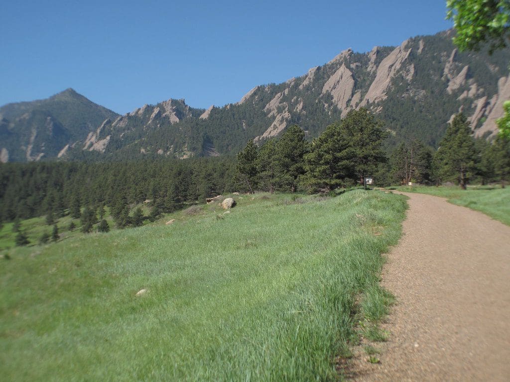
Today’s Outdoor Picture of the Day captures the expansive beauty of Boulder’s Mesa Trail, a 6.3-mile point-to-point trek from the base of the Flatirons at Chautauqua Park all the way to Eldorado Springs. With golden morning light spilling over sandstone formations and pine-covered ridges, this legendary trail is a celebration of Boulder’s wild spirit and sweeping Front Range views.
How to Get There
Start your hike at Chautauqua Park, located at 900 Baseline Rd, Boulder, CO 80302. It’s a short drive from downtown Boulder, with well-marked signs and a large trailhead parking area. Paid parking is in effect, and early morning is the best time to secure a spot and enjoy the trail in solitude.
From the parking lot, follow the trail signs near the Chautauqua Auditorium. The Mesa Trail begins just west of the main trail junction and heads steadily south along the base of the Flatirons.
Enchanted Mesa Trail, Boulder, CO
Mesa Trail Details
-
Total Distance: Approximately 6.3 miles one way
-
Round Trip: About 12.6 miles out and back
-
Elevation Gain: Around 1,700 feet net elevation change
-
Difficulty: Moderate
-
Trail Surface: Singletrack dirt path with rolling elevation
-
Dogs: Allowed on leash or under voice-and-sight control with City of Boulder OSMP tag
-
Bicycles: Not permitted
-
Horses: Permitted on most segments
This long, scenic route offers a little of everything—meadows, forests, canyons, and views of the Flatirons rising sharply overhead. Whether you’re a seasoned hiker or a trail runner seeking distance and beauty, Mesa Trail delivers.
Logistics and Trail Tips
For those not looking to do the full round trip, consider arranging a shuttle or parking a second vehicle at the South Mesa Trailhead near Eldorado Springs. There is no return transit from the far end of the trail, so plan accordingly.
The Mesa Trail connects with several other well-known routes including Enchanted Mesa, Shadow Canyon, NCAR Trail, and Fern Canyon, offering options for loop hikes and further exploration.
Early mornings provide the best light and cooler temperatures, especially during summer months. Be sure to bring water, as there are no drinking sources along the way, and prepare for varied weather.
Conservation and Resources
The Mesa Trail is part of Boulder’s renowned Open Space and Mountain Parks (OSMP) system, which protects over 45,000 acres of ecologically rich land. To learn more or view current trail conditions, visit the City of Boulder OSMP site.
For detailed maps, trail reviews, and elevation profiles, check out the AllTrails Mesa Trail page, a useful planning tool for both casual and experienced hikers.