Hike of the Week: Mount Sanitas
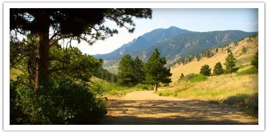
Photo Credit: dayhikesneardenver.com contributor
One of the most popular hiking trails in Boulder is Mount Sanitas, and like many hiking areas, Mount Sanitas gives hikers options for creating the perfect hike. It also, like many other local hiking trails is only a few minutes out of town, but gives one the illusion that he/she is out in the wilderness far away from city life. Because of the trail’s popularity, one will most likely encounter other hikers, making Sanitas a great option for those new to solo hiking.
Here are some options when hiking Sanitas:
- The Loop – This is the most difficult of the options for it involves a steep ascent up the mountain, climbing up rock and log stairs. A good replacement for leg day at the gym, the loop is a little over 3 miles and is accessed by Sanitas Valley Trail, then left on Mount Sanitas Trail, then to East Ridge, then finish the loop with Sanitas Valley Trail
- Sanitas Valley – The Sanitas Valley Trail option is the easiest of the trails with its wide manicured gravel path, little elevation gain, and its 1 mile in-n-out path: the whole family will enjoy this leisurely hike.
- Sunshine Canyon/Lion Lair Loop – This trail, the newest addition to the Sanitas trail system is the longest of the trails measuring a little over 5 miles, but has a less challenging ascent. Begin at the Red Rocks Trail going south then go to Sunshine Canyon trail. When you reach the end of the trail, cross the road and head up the valley until you see a faint footpath after the culvert on the uphill side: this is the Lion’s Lair Alternative trail which will join Lion’s Lair Trail and take you to the summit. At the summit take Mount Sanitas trail down; the descent is steep, but quick with rock and log stairs.
Mount Sanitas is not only one of the “musts” for hikers in the Boulder County area, but it also has a couple areas for bouldering, is a popular trail running area, and rewards hikers with beautiful views of the Continental Divide and the city below.
Things to know:
- Restrooms and picnic tables are located at the Centennial Trailhead.
- Park at the Centennial Trailhead, or on the south side of Mapleton Street.
- Be aware of your surroundings and for wildlife: coyotes, foxes, mule deer, mountain lions, and raptors have been spotted in the area.
Happy Adventuring!